The Mighty Whanganui River
The Whanganui River history is stooped in legends of early New Zealand.
In the centre of Te Ika-a-Maui (the North Island) once stood the mighty mountains Ruapehu, Ngauruhoe, Tongariro and Taranaki, together with the beautiful maiden Pihanga.
All the mountains loved Pihanga, but it was the venerable Tongariro whom she chose to be her husband. They lived together in peace for many centuries, until Tongariro caught Taranaki in a love affair with Pihanga, and a mighty conflict ensued.
Tongariro violently erupted casting red hot stones and lava over Taranaki, who was forced to flee. He plunged
to the west, tearing a furrow in the earth behind him, and when he reached the coast he traveled north, until he found peace and rest in his present position, where he was known for a while as Mt Egmont.
From the side of Tongariro a stream of clear water flowed to fill the trench the fleeing Taranaki had torn in the earth, to form what we know today as the Whanganui River.
Kupe, the discoverer of New Zealand, is said to have explored the tidal reaches of the Whanganui, while the chief Tamatea is credited with having made the first exploration of the entire river.
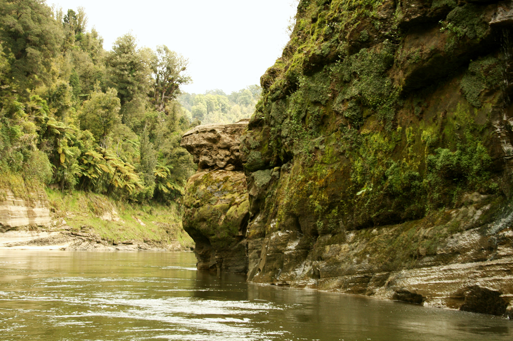
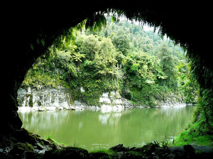
Tamatea left many place names: Te Punga where he cast anchor, Tangahoe where he cut paddles, Tangarakau where he felled a tree for repairs to the canoe, Te Ure-a-Tamatea a rock feature, and Tamatea’s Cave, where he sought shelter.
In early times the sheltered river valley supported a large Maori population. Abundant food sources. excellent defensive sites for fortified ‘pa,’ together with the gentle gradient and easy navigability of the river itself, lead to the establishment of villages along the length of the river and its tributaries.
The first mayor European influences came to the valley in the 1840’s with the beginnings of a settlement at Wanganui, and the arrival of missionaries. The Rev. Richard Tailor established missions along the length of the river, and through his understanding of the Maori people was an important arbiter between Maori and European during the land problems of the time. In the 1850’s Father Lampila brought the Roman Catholic faith to the river tribes, especially those along the lower reaches.
Missionary influence instigated a change of lifestyle among the Maori people – tribal warfare ceased, large scale cultivation began and accordingly villages moved from fortified sites to those more suitable for farming.
The Rev. Tailor was asked for names for many of these new villages, and it is the Maori pronunciations of his suggestions which remain today, such as Hiruharama (Jerusalem), Ranana (London), Koriniti (Corinth), and Atene (Athens).
The populations of other villages similarly named have long since dispersed. By 1848 an estimated 30,000 acres of wheat were grown by the Maori people along the river. and through the influence of both the Rev. Tailor and Father Lampila, using financial assistance from Governor Grey, several water driven flour mills were built. The Kawana Mill, near Matahiwi, was restored to original state in 1980 and is now an interesting reminder of the days when flour milling was an important industry in the river valley.
 In the 1860’s the Hauhau, members of the cultist Pae marire religion, came from Taranaki to the Whanganui River and gained many converts from the up-river tribes. They erected ceremonial ‘Niu’ Poles at their strongholds and moved down river with the intention of attacking the European settlers in Wanganui.
In 1864 they were repelled by lower river tribes in successive battles at Moutoa Island and Ohoutahi, and, in 1865 at Pipiriki they finally surrendered to the militia. (HauHau ‘niu’ poles are still standing at Maraekowhai and Arimatia.)
Although Wanganui had been settled by the New Zealand Land Company in the 1840’s, the Taumarunui area was not reached by Europeans until the late 1800’s, following the end of the King Wars. Initially the southern King Country was opened up for milling, but Taumarunui became an important transport junction when the railway reached the town in 1903.
Progress in the area accelerated further in 1908, with the completion of the Main Trunk Line.
The possibility of steamer navigation on the river had been realized during the HauHau wars of the 1860’s, when the “Gundagai” and “Moutoa” carried soldiers and supplies well beyond the tidal zone. In 1891 the firm of A. Hatrick and Co. began a regular steamer service to Pipiriki, and in 1903 extended the service to Taumarunui to link with the Main Trunk railway.
Wanganui Wharves Pipiriki House P.S. Waimarie
Wanganui Wharves around 1920. Click for more info Pipiriki House. Click for more info P.S. Waimarie. Click for more info
S.S./M.V. Wakapai Taumarunui Landing M.V. Otunui
S.S./M.V. Wakapai. Click for more info Taumarunui Landing. Click for more info M.V. Otunui. Click for more info
In 1891 the Whanganui River Trust was established, under the River Boards Act of 1884, for the purpose of channel clearing and maintenance to ensure a clear passage for the steamers, many of which were in excess of 100 feet long.
The steamers linked Pipiriki House, then one of the most up-to-date hotels in New Zealand, and the Houseboat, an impressive “floating hotel’ moored first at the Ohura River junction and later, downstream in the Retaruke River. This was one of the world’s most outstanding tourist services and in 1905 12,000 tourists were recorded as having stayed at Pipiriki House.
When the riverboat service was at it’s height, twelve steam or motor vessels and three motorized canoes plied the river, ranging from the 105 foot stern wheeler “Manuwai” licensed to carry 400 passengers, to the smaller launches and canoes which operated on the upper reaches. The 100-year-old paddle steamer M.V. “Waimarie” has been restored and often cruises between Upokongaro and Wanganui.
In conjunction with the tourist service the steamers provided transport for the people of the river settlements, a mail service, and cartage for farmers. A total of 4,000 wool bales was brought down by the steamers in 1928.
Bush clearing and subsequent pastoral development had began in the late 1880’s and this continued into the 1920’s along the river banks. Conversion of the bush to grassland was achieved by the ‘cut and burn’ system which, in 1912, prompted the River Trust to approach Government asking for protection of the river banks from the effects of development. The resulting reservation of land has continued through to the present.
However, decreasing soil fertility, increased erosion, bush re-generation, the fall in prices for pastoral products in the 1930’s depression, and problems of access, saw the gradual decline and abandonment of many farm holdings. In one example, the Mangapurua Valley was cleared of its virgin forest, developed pastorally, and then abandoned by its pioneering settlers, all between the years 1917 and 1942.
Land clearing and development work over this period provided employment for the remaining Maori people of the river, who had by then lost much of their traditionally self-sufficient life style. In the 1920’s and 1930’s more work became available with the Maori Farm development scheme and River Road construction, but by 1940 this work had petered out, and the population of villages declined, in many cases dispersing altogether.
Rising costs, the abandonment of farms and villages, road development and a decline in the tourist trade eventually led to the end of the steamer service in 1958. In 1959 Pipiriki House burnt down and was not replaced.
A new era in the history of river transport began in 1957, when Mr C.W.F. Hamilton traveled the length of the river in his newly invented “jet boat”. In 1958 the “Rangimarie” became the first jet boat in the world licensed to carry passengers, and was operated on the Whanganui river.
Thus tourist and recreational interests in the river were gradually revived in the late 1950’s, and in 1958 the Whanganui River Scenic Board was formed. This Board, in conjunction with the Department of Lands and Survey became responsible for the administration of the scenic reserves adjoining the river, taking over this function of the original River Trust Board, which had been wound up in 1940.
A permanent ranger was appointed in 1974, and in 1980 the Scenic Board became the Whanganui River Reserves Board, giving recognition to its wider role of administering not only scenic but also historical, recreation and scientific reserves along the river.
The Whanganui River Reserves became New Zealand’s eleventh National Park in December 1986. 74,000 ha of former Scenic Reserves, Crown Land and State Forest form the Park. The Department of Lands & Survey was disestablished in March 1987 and the Department of Conservation took over control of all National Parks, Reserves and other protected areas.
Acknowledgement
Special thanks to Cameron McNeil of Wanganui for his time and effort in compiling and documenting information on the historic Hatrick Riverboat fleet which plied the Whanganui River in New Zealand from 1891 to 1958. The full story can be found at www.riverboats.homestead.com